TheMaritime.net
Dry Bulk Freight Index2,490 -1.3%Capesize3,538 -2.8%Panamax2,124 +0.7%Dirty Tanker Index1,935 +1.1%Supramax1,668 -0.1%Clean Tanker Index1,280 -1.4%Handysize947 +0.2%Dry Bulk Freight Index2,490 -1.3%Capesize3,538 -2.8%Panamax2,124 +0.7%Dirty Tanker Index1,935 +1.1%Supramax1,668 -0.1%Clean Tanker Index1,280 -1.4%Handysize947 +0.2%Dry Bulk Freight Index2,490 -1.3%Capesize3,538 -2.8%Panamax2,124 +0.7%Dirty Tanker Index1,935 +1.1%Supramax1,668 -0.1%Clean Tanker Index1,280 -1.4%Handysize947 +0.2%Dry Bulk Freight Index2,490 -1.3%Capesize3,538 -2.8%Panamax2,124 +0.7%Dirty Tanker Index1,935 +1.1%Supramax1,668 -0.1%Clean Tanker Index1,280 -1.4%Handysize947 +0.2%Dry Bulk Freight Index2,490 -1.3%Capesize3,538 -2.8%Panamax2,124 +0.7%Dirty Tanker Index1,935 +1.1%Supramax1,668 -0.1%Clean Tanker Index1,280 -1.4%Handysize947 +0.2%Dry Bulk Freight Index2,490 -1.3%Capesize3,538 -2.8%Panamax2,124 +0.7%Dirty Tanker Index1,935 +1.1%Supramax1,668 -0.1%Clean Tanker Index1,280 -1.4%Handysize947 +0.2%
General Cargo🇦🇬 Antigua and BarbudaActive

LEMLAND

IMO
9415040
MMSI
304581000
Call Sign
V2GZ4

Technical Specifications

Key Figures

Gross Tonnage
6,577GT
Deadweight
8,850DWT
Length Overall
129.4m
Beam
17.31m
Draught
7.5m
Year Built
2009

Live Tracking

Current Position

Live AIS · 13 d ago
Position
50.966°N · 8.150°W
Speed
8.5 kn
Course
222°
Status
Under way using engine
Destination US MSYETA Jul 7, 11:00 PMLaden · 7.2 m
Underway to

Port of New Orleans

USAAIS: US MSY
Distance
3741 nm
great-circle
ETA (computed)
Speed now
8.5 kn
Under way using engine
Crew ETA
not reported

Resolved from the live AIS destination. Distance is the real sea route (around land and through canals); the computed ETA is at the vessel’s passage speed. A destination is the crew’s stated intent, not a confirmed fixture.

Intelligence

Risk & Sustainability

Risk scoreMedium
77/ 100
Safety68
Compliance95
Environment68
Carbon intensity · 2024D
6,811t CO₂
AER (CO₂/capacity·nm)
16.2
Fuel burned
2,125 t
Technical
EEXI (10.23 gCO₂/t·nm)

Verified reported figure. Band is peer-relative, not official IMO CII.

Operational Status

Activity

Under wayLow confidenceFix 12 days ago

Making way at sea speed on its latest broadcast.

Speed
8.5 kn
Nav status
Under way using engine
Last broadcast
12 days ago
Hull age
17 yr

Read from the single most-recent AIS broadcast we hold for this hull — we keep no position history, so this is a point-in-time posture, not a dwell inference. Derived in-house from our own AIS feed; weight it by the broadcast age above.

Composite Risk

Risk Score

69/100
Elevated riskLow confidence40% component coverage

Multiple adverse factors, or a hard ship-specific signal, lift this hull above the fleet norm.

PSC detentionsno data
Sanctions exposureno data
Dark-fleet signalno data
Hull age48
Flag register100

A coverage-weighted blend of the 2 components we could read for this hull — the weights renormalise over only the components present, so a thin read is never inflated and a hull is never credited a “safe 0” for a signal it has no row for. This headline is flagged low-confidence (a thin or structural-only read) and should not be treated as a verdict. Higher means riskier. Derived in-house from government-open port-State-control, flag, sanctions and our own vessel data; weight it by the coverage above.

Estimated

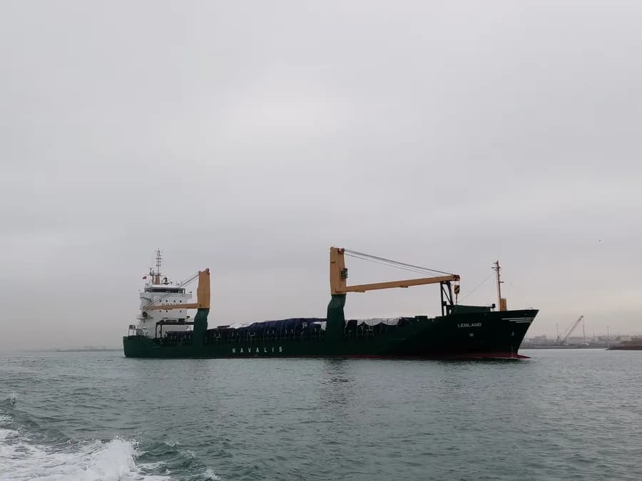
Capacity & Classification

Cargo capacity at draughtHigh confidence
~8,850t at summer draught

Other · summer draught 7.5 m · 18.1 t per cm immersion

Estimated intake by draught
5.25 m~4,786 t
5.63 m~5,463 t
6 m~6,141 t
6.38 m~6,818 t
6.75 m~7,495 t
7.13 m~8,173 t
7.5 m~8,850 t

Estimate only — modelled from deadweight (hull geometry) using a first-principles hydrostatic model, not measured hydrostatic tables. The design draught it is anchored to is unreliable across the fleet.

Commercial

Voyage Estimate

From 8,850 DWT · ~9 t/day · bunker @ live VLSFO.
LEMLAND

Visual Archive

Gallery

Explore More

Similar Vessels

Community

Vessel Comments