- IMO
- 7326245
- MMSI
- 316036229
- Call Sign
- VDBY
Technical Specifications
Key Figures
Live Tracking
Current Position
Where it waited most
Most time stopped at Brevort — 8 h across 1 stay.
- 1Brevort8 h
- 2Hamilton8 h
- 3Saint-Catharines6 h · 10×
- 4Port Colborne2 h · 2×
Derived from the AIS track — runs of near-zero speed (anchored, moored or drifting) snapped to the nearest port. Builds up as we observe the vessel.
Resolved from the live AIS destination. Distance is the real sea route (around land and through canals); the computed ETA is at the vessel’s passage speed. A destination is the crew’s stated intent, not a confirmed fixture.
Intelligence
Risk & Sustainability
- Saint-CatharinesIn portJul 1, 2026
- Port Colborne0.1 dJul 1, 2026
- Port Colborne0.0 dJun 28, 2026
- Saint-Catharines0.1 dJun 28, 2026
- Saint-Catharines0.0 dJun 28, 2026
AIS-derived from our live feed.
Compliance
Safety Record
- TOTAL FAILURE OF ANY MACHINERY OR TECHNICAL SYSTEMMinorOct 15, 2025Bar Point, ONTARIO (ON)
On 15 October 2025, the bulk carrier "ALGOMA COMPASS" reported having experienced the total failure of its port main engine in the Detroit River off Amherstburg, ON. The vessel resumed its voyage to Windsor, ON where the crew performed repairs.
- INTENTIONAL BEACHING/GROUNDING/ANCHORING to avoid occurrenceModerateNov 4, 2023Île du Grenadier, QUEBEC (QC)
On 04 November 2023, the bulk carrier "ALGOMA COMPASS" reported having sustained a total failure of its bow thruster's generator on Lac Saint-François, QC. The vessel was anchored off Saint-Zotique, QC and the crew conducted repairs.
- STRIKING - Allision with a fixed object (striking - includes berthed/docked vessels)SeriousNov 21, 2022Port Colborne, ONTARIO (ON)
On 21 November 2022, the self-unloader vessel "ALGOMA COMPASS" reported having struck an abutment of Bridge 21 while proceeding downbound on the Welland Canal off Port Colborne, ON. The vessel proceeded to the west wall at Lock 8 to await for an inspection of damages.
- TOTAL FAILURE OF ANY MACHINERY OR TECHNICAL SYSTEMMinorApr 29, 2021Windsor, ONTARIO (ON)
On 29 April 2021, the bulk carrier "ALGOMA COMPASS" reported sustaining a machinery failure and needing to anchor in the Detroit River off Windsor, ON. The crew carried out repairs and the vessel resumed its voyage.
- STRIKING - Allision with a fixed object (striking - includes berthed/docked vessels)SeriousJun 11, 2018St. Catharines, ON, ONTARIO (ON)
On 11 June 2018, the bulk carrier "ALGOMA COMPASS" made contact with the ship arrester while transiting Lock No.5 in the Welland Canal, ON.
Recorded marine occurrences naming this vessel.
Operational Status
Activity
Making way at sea speed on its latest broadcast.
Read from the single most-recent AIS broadcast we hold for this hull — we keep no position history, so this is a point-in-time posture, not a dwell inference. Derived in-house from our own AIS feed; weight it by the broadcast age above.
Port calls
2 recent · AIS-detectedArrivals, time in port and the load/discharge inferred from the draught change — detected from AIS track history. An open call means the vessel is still in port (no departure observed yet).
- no cargo change→ · 2 h in port· draught 7.5→7.5 m
- no cargo change→ · 2 h in port· draught 7.5→7.5 m
Method: each call is a run of fixes inside a port’s geofence confirmed by a stop (or an AIS gap); load/discharge is the sign of the draught delta over the call. Indicative — arrivals before our AIS history began read from the first observation.
Where it waits
2 ports · 5 h totalTime-in-port summed by port from the AIS-detected port-call history — the ports this vessel has spent the most time at, longest first.
- Port Colborne· Canada2 h1 call · 2 h avg
- Port Weller· Canada2 h1 call · 2 h avg
Based on 2 completed calls observed since — open calls (no departure yet) are excluded. The distribution sharpens as AIS history accrues.
Composite Risk
Risk Score
Multiple adverse factors, or a hard ship-specific signal, lift this hull above the fleet norm.
A coverage-weighted blend of the 2 components we could read for this hull — the weights renormalise over only the components present, so a thin read is never inflated and a hull is never credited a “safe 0” for a signal it has no row for. This headline is flagged low-confidence (a thin or structural-only read) and should not be treated as a verdict. Higher means riskier. Derived in-house from government-open port-State-control, flag, sanctions and our own vessel data; weight it by the coverage above.
Estimated
Capacity & Classification
Bulker · summer draught 6.1 m · 40.2 t per cm immersion
Estimate only — modelled from deadweight (deadweight regression) using a first-principles hydrostatic model, not measured hydrostatic tables. The design draught it is anchored to is unreliable across the fleet.
density DWT/GT=1.72 is consistent with declared bulker
Declared type is consistent with the class implied by the vessel’s size signals. Inferred via our shared size-based classifier.
Commercial
Voyage Estimate
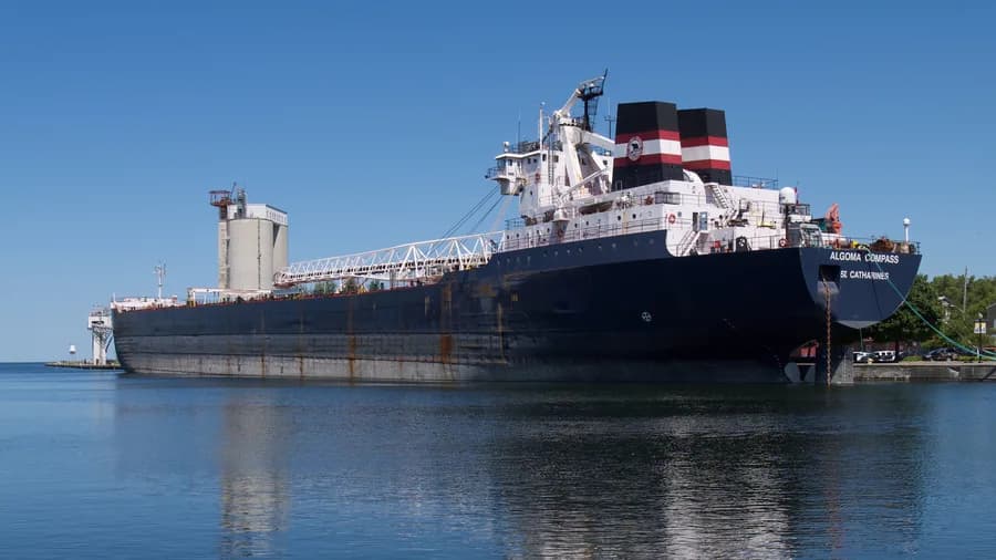
Visual Archive
Gallery
Explore More
Similar Vessels
Community
Vessel Comments