- IMO
- 9900590
- MMSI
- 316047555
- Call Sign
- CFA3521
Technical Specifications
Key Figures
Live Tracking
Current Position
Where it waited most
Most time stopped at Campbell River — 6 d across 49 stays.
- 1Campbell River6 d · 49×
- 2Harmac25 h · 4×
Derived from the AIS track — runs of near-zero speed (anchored, moored or drifting) snapped to the nearest port. Builds up as we observe the vessel.
Intelligence
Risk & Sustainability
- Campbell River0.6 dJul 1, 2026
- Campbell River0.1 dJun 30, 2026
- Campbell River0.0 dJun 30, 2026
- Campbell River0.0 dJun 30, 2026
- Campbell River0.1 dJun 30, 2026
AIS-derived from our live feed.
Compliance
Safety Record
- TOTAL FAILURE OF ANY MACHINERY OR TECHNICAL SYSTEMMinorJul 18, 2024Gabriola, BRITISH COLUMBIA (BC)
On 18 July 2024, the ferry "ISLAND KWIGWIS" reported having sustained a total failure of one of its generators prior to departing from Decanso Bay, BC. The vessel left the harbour and the crew addressed the issue while underway.
- TOTAL FAILURE OF ANY MACHINERY OR TECHNICAL SYSTEMMinorJan 21, 2023Jack Point, BRITISH COLUMBIA (BC)
On 21 January 2023, the ferry "ISLAND KWIGWIS" reported experiencing a generator issue while proceeding in Nanaimo Harbour off Protection Island, BC. The vessel resolved the problem at sea.
- TOTAL FAILURE OF ANY MACHINERY OR TECHNICAL SYSTEMMinorJan 16, 2023Descanso Bay, BRITISH COLUMBIA (BC)
On 16 January 2023, the ferry "ISLAND KWIGWIS" reported a generator issue while in Descanso Bay, BC. The vessel continued on daily runs using its other generator.
- TOTAL FAILURE OF ANY MACHINERY OR TECHNICAL SYSTEMMinorNov 25, 2022Jack Point, BRITISH COLUMBIA (BC)
On 25 November 2022, the rail ferry "ISLAND KWIGWIS" reported that one of its generators was out of service while moored in Nanaimo Harbour, BC. The generator was repaired, and the vessel continued its scheduled voyages.
Recorded marine occurrences naming this vessel.
Operational Status
Activity
Stopped, anchored or moored on its latest broadcast — parked, not necessarily withdrawn.
Read from the single most-recent AIS broadcast we hold for this hull — we keep no position history, so this is a point-in-time posture, not a dwell inference. Derived in-house from our own AIS feed; weight it by the broadcast age above.
Port calls
2 recent · AIS-detectedArrivals, time in port and the load/discharge inferred from the draught change — detected from AIS track history. An open call means the vessel is still in port (no departure observed yet).
- op. unknownIn port since
- op. unknownIn port since
Method: each call is a run of fixes inside a port’s geofence confirmed by a stop (or an AIS gap); load/discharge is the sign of the draught delta over the call. Indicative — arrivals before our AIS history began read from the first observation.
Composite Risk
Risk Score
No strong adverse signal on the components we could read for this hull.
A coverage-weighted blend of the 2 components we could read for this hull — the weights renormalise over only the components present, so a thin read is never inflated and a hull is never credited a “safe 0” for a signal it has no row for. This headline is flagged low-confidence (a thin or structural-only read) and should not be treated as a verdict. Higher means riskier. Derived in-house from government-open port-State-control, flag, sanctions and our own vessel data; weight it by the coverage above.
Estimated
Capacity & Classification
Other · summer draught 2.3 m · 1.8 t per cm immersion
Estimate only — modelled from deadweight (deadweight only) using a first-principles hydrostatic model, not measured hydrostatic tables. The design draught it is anchored to is unreliable across the fleet.
Commercial
Voyage Estimate
Fleet Management
Ownership & Management
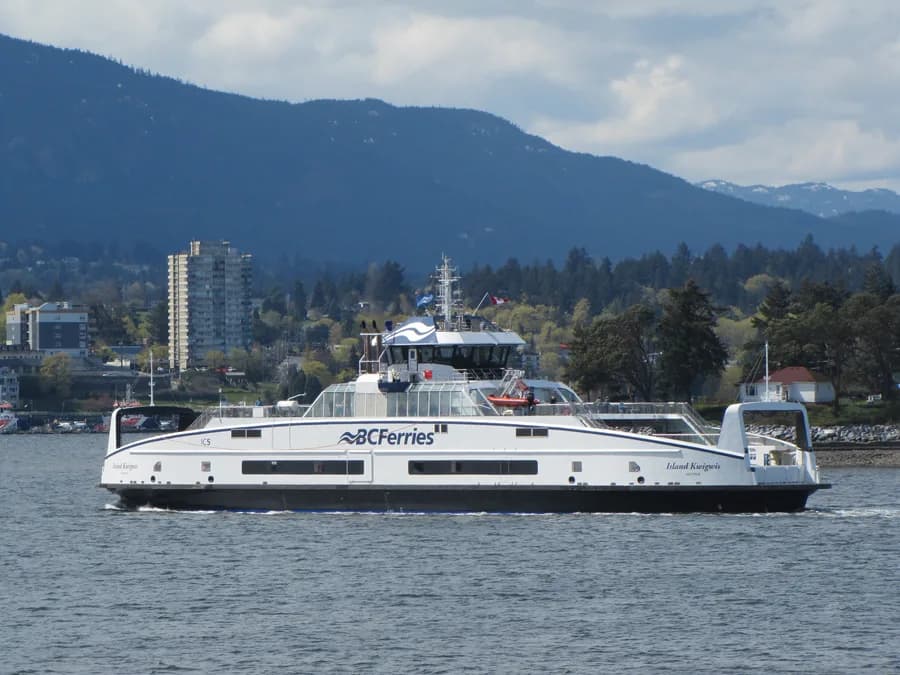
Visual Archive
Gallery
Explore More
Similar Vessels
Community
Vessel Comments