- IMO
- 9669330
- MMSI
- 538005216
- Call Sign
- V7BY3
Technical Specifications
Key Figures
Live Tracking
Current Position
Where it waited most
Most time stopped at Skagen Havn — 8 h across 1 stay.
- 1Skagen Havn8 h
Derived from the AIS track — runs of near-zero speed (anchored, moored or drifting) snapped to the nearest port. Builds up as we observe the vessel.
Resolved from the live AIS destination. Distance is the real sea route (around land and through canals); the computed ETA is at the vessel’s passage speed. A destination is the crew’s stated intent, not a confirmed fixture.
Intelligence
Risk & Sustainability
An independent cross-check of the estimate above for Bulker (segment · size · age · market).
Estimate from $/dwt of similar-size, similar-age ships sold in the last 24 months. Indicative, not a certified valuation.
- AER (CO₂/capacity·nm)
- 3.7
- Fuel burned
- 3,040 t
- Technical
- EEXI (3.61 gCO₂/t·nm)
Verified reported figure. Band is peer-relative, not official IMO CII.
Compliance
Safety Record
- SUSTAINS DAMAGE RENDER UNSEAWORTHY/UNFIT FOR PURPOSE - Unfit for purpose - ice, weather, etc.SeriousMar 26, 2014Codroy, NEWFOUNDLAND AND LABRADOR (NL)
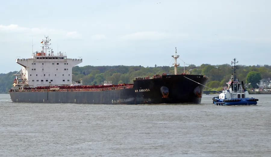
On 26 March 2014, the MV "AM ANNABA", with 23 POB, reported damage to two propeller blades 31 nm WNW of Codroy, NL while navigating in ice. There was no pollution reported.
Recorded marine occurrences naming this vessel.
Operational Status
Activity
Making way at sea speed on its latest broadcast.
Read from the single most-recent AIS broadcast we hold for this hull — we keep no position history, so this is a point-in-time posture, not a dwell inference. Derived in-house from our own AIS feed; weight it by the broadcast age above.
Composite Risk
Risk Score
Some elevated factors — typically age or a lower-graded flag — but no acute ship-specific flag.
A coverage-weighted blend of the 2 components we could read for this hull — the weights renormalise over only the components present, so a thin read is never inflated and a hull is never credited a “safe 0” for a signal it has no row for. This headline is flagged low-confidence (a thin or structural-only read) and should not be treated as a verdict. Higher means riskier. Derived in-house from government-open port-State-control, flag, sanctions and our own vessel data; weight it by the coverage above.
Estimated
Capacity & Classification
Bulker · summer draught 14.6 m · 65 t per cm immersion
Estimate only — modelled from deadweight (hull geometry) using a first-principles hydrostatic model, not measured hydrostatic tables. The design draught it is anchored to is unreliable across the fleet.
density DWT/GT=1.84 is consistent with declared bulker
Declared type is consistent with the class implied by the vessel’s size signals. Inferred via our shared size-based classifier.
Commercial
Voyage Estimate
Visual Archive
Gallery
Explore More
Similar Vessels
Community
Vessel Comments